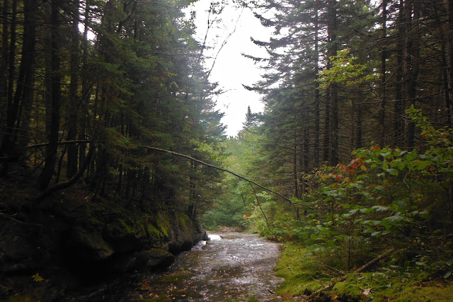
The high elevations of the White Mountains wasn't something that was new to me. There were 4,000 to 6,000 foot mountains down south in The Smokies, and peaks in Virginia just as high as these. In fact, I had already been over the highest point on the A.T, Clingmans Dome, but I had still yet to be on mountains like these. This far north. Mountains above tree line, in the alpine zone where the climate is harsh was all new to me. Lucky the weather has been fairly good and I've gotten to take in some amazing views.
Lamberts Ridge
View of Smarts Mountain from Lamberts Ridge
Going up Mt. Cube
View of Smarts Mountain from Mt Cube
Mt Moosilauke. My first mountain in the alpine zone.
The weather above tree line can change drastically. In this case it was for the better.
Steep trail of the north side of moosilauke
View of Kinsman
Two-thirds on Kinsman with a view of Franconia Ridge
Steep downhill off Kinsman
Lonesome Lake and Franconia Ridge
CPD coming up Little Haystack

Franconia Ridge
CPD chillin'
Mt. Lincoln
CPD coming Mt. Lincon
Franconia Ridge
View of Franconia Ridge from Mt. Garfield
Just a game of Twister on top of Mt. Garfield
Stupid downhill off Mt. Garfield. Not just rocks but also a stream running down it. Just another morning on the A.T in the Whites...
Webster Cliffs
Mt. Washington lurking in the background. Mt. Washington is the second highest peak on the A.T, 6,288 ft and the so called "worst weather in the world" with the highest recorded wind speed of 230 mph. One of backpacker magazines 10 most dangerous hikes in America. The mountain is part of the Presidential Range with 13+ miles above tree line.
Coming up the Presidential Range. I think that might be Eisenhower.
A look back at the range.
Research on some of the alpine plants
The distance and size of these mountains can be pretty deceiving. They all look fairly close and feel like you can just run to the top but Mt. Washington is still miles away.
Slept in "The Dungeon" at the Lake of Clouds hut. A mile from the summit of Mt.Washington.
Something like...'Turn back if the weather is bad. Many have died from exposure even in summer...' Blah Blah...I do take seriously though.
A look back down
Before you make fun of my skirt, its a 'rain kilt' and it was a cold and wet morning.
Coming off Washington
More Presidential Range. Clay, Jefferson, Madison, Adams.
A look back a Mt. Washington
Mt. Adams
Mt. Madison and the Madison Springs Hut. The huts are like shelters in the Whites except they cost people 90$ to stay at. Thru hikers can work for stay.
Steep trail up Madison
Summit of Madison
Coming off the range and taking a look back.


